There has been significant progress in the graphical realism of digital humans in recent years. This work investigates the realistic portrayal of emotions beyond facial expressions by analysing how skin colour changes when expressing different emotional states. The study combines existing knowledge from old painters, photogrammetry data, thermal imaging, and skin colouration maps to create an artistic guideline to portray emotions realistically, resulting in the proposal of a set of colour maps representing the six basic emotions. By using skin colour changes to represent emotional states, the proposed colour maps offer an alternative workflow for portraying emotions. During the experiment of this research four of these proposed colour maps, which represent neutrality, anger, disgust, and happiness, were preferred over traditional alternatives in terms of realism perception and likeability. The findings have implications for the development of digital human technology, particularly in the creation of more realistic and expressive digital characters.
LINK
Urban planning will benefit from tools that can assess the vulnerabilityto thermal stress in urban dense cities. Detailed quick-scan heat stressmaps, as made in this study for Johannesburg, have proven valuable inthe decision-making process on this topic. It raised awareness on theurgent need to implement measures to tackle the effects of climatechange and urbanization. Awareness on heat stress has led to theimplementation of measures to mitigate the effects of climate change.As in other countries, nature-based solutions (e.g. green roofs and walls,swales, rain gardens, planting trees etc) are considered in urban areasin South Africa for various reasons. The awareness of the effect ofnature based solutions on heat stress is still low, which can be improvedby the use of heat stress maps. Some of these measures are alreadymapped on the open source web tool, Climate-scan(www.climatescan.nl) for international knowledge exchange aroundthe globe.
DOCUMENT

Urban flooding and thermal stress have become key issues for many cities around the world. With the continuing effects of climate change, these two issues will become more acute and will add to the serious problems already experienced in dense urban areas. Therefore, the sectors of public health and disaster management are in the need of tools that can assess the vulnerability to floods and thermal stress. The present paper deals with the combination of innovative tools to address this challenge. Three cities in different climatic regions with various urban contexts have been selected as the pilot areas to demonstrate these tools. These cities are Tainan (Taiwan), Ayutthaya (Thailand) and Groningen (Netherlands). For these cities, flood maps and heat stress maps were developed and used for the comparison analysis. The flood maps produced indicate vulnerable low-lying areas, whereas thermal stress maps indicate open, unshaded areas where high Physiological Equivalent Temperature (PET) values (thermal comfort) can be expected. The work to date indicates the potential of combining two different kinds of maps to identify and analyse the problem areas. These maps could be further improved and used by urban planners and other stakeholders to assess the resilience and well-being of cities. The work presented shows that the combined analysis of such maps also has a strong potential to be used for the analysis of other challenges in urban dense areas such as air and water pollution, immobility and noise disturbance.
DOCUMENT

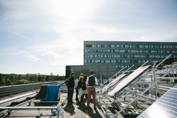
Deploying robots from indoor to outdoor environments (vise versa) with stable and accurate localization is very important for companies to secure the utilization in industrial applications such as delivering harvested fruits from plantations, deploying/docking, navigating under solar panels, passing through tunnels/underpasses and parking in garages. This is because of the sudden changes in operational conditions such as receiving high/low-quality satellite signals, changing field of view, dealing with lighting conditions and addressing different velocities. We observed these limitations especially in indoor-outdoor transitions after conducting different projects with companies and obtaining inaccurate localization using individual Robotics Operating Systems (ROS2) modules. As there are rare commercial solutions for IO-transitions, AlFusIOn is a ROS2-based framework aims to fuse different sensing and data-interpretation techniques (LiDAR, Camera, IMU, GNSS-RTK, Wheel Odometry, Visual Odometry) to guarantee the redundancy and accuracy of the localization system. Moreover, maps will be integrated to robustify the performance and ensure safety by providing geometrical information about the transitioning structures. Furthermore, deep learning will be utilized to understand the operational conditions by labeling indoor and outdoor areas. This information will be encoded in maps to provide robots with expected operational conditions in advance and beyond the current sensing state. Accordingly, this self-awareness capability will be incorporated into the fusion process to control and switch between the localization techniques to achieve accurate and smooth IO-transitions, e.g., GNSS-RTK will be deactivated during the transition. As an urgent and unique demand to have an accurate and continuous IO-transition towards fully autonomous navigation/transportation, Saxion University and the proposal’s partners are determined to design a commercial and modular industrial-based localization system with robust performance, self-awareness about the localization capabilities and less human interference. Furthermore, AlFusIOn will intensively collaborate with MAPS (a RAAKPRO proposed by HAN University) to achieve accurate localization in outdoor environments.
In het RAAK-project, genaamd Groningen MAPS, is er veel data en kennis vergaard van waaruit antwoorden zijn geformuleerd op verschillende vragen rondom belasting en belastbaarheid van (top)sporters. Het onderzoek naar de factoren die invloed hebben op de prestaties en het blessurerisico van sporters heeft opgeleverd dat we nu meer inzicht hebben in de informatie die nodig is om gericht te zoeken naar verbanden tussen belasting en belastbaarheid.We hebben echter nog niet gekeken naar de data vanuit een datamining perspectief. Datamining is het gericht zoeken naar verbanden in een database met als doel het opstellen van profielen. Deze profielen kunnen nieuwe inzichten geven waardoor sporters van nog betere feedback voorzien kunnen worden. Het doel van het Top-up project is om kennis te ontwikkelen over het automatiseren van de verwerking en analyse van datastromen. Dit zal leiden tot een datasysteem wat automatisch analyses uitvoert achter de schermen. Met dit datasysteem kan de Groningen MAPS-data verder geanalyseerd worden (door middel van datamining) om nieuw inzicht te verkrijgen op het gebied van patronen in belasting en belastbaarheid van (top)sporters.
In het RAAK-project, genaamd Groningen MAPS, is er veel data en kennis vergaard van waaruit antwoorden zijn geformuleerd op verschillende vragen rondom belasting en belastbaarheid van (top)sporters. Het onderzoek naar de factoren die invloed hebben op de prestaties en het blessurerisico van sporters heeft opgeleverd dat we nu meer inzicht hebben in de informatie die nodig is om gericht te zoeken naar verbanden tussen belasting en belastbaarheid. We hebben echter nog niet gekeken naar de data vanuit een datamining perspectief. Datamining is het gericht zoeken naar verbanden in een database met als doel het opstellen van profielen. Deze profielen kunnen nieuwe inzichten geven waardoor sporters van nog betere feedback voorzien kunnen worden. Het doel van het Top-up project is om kennis te ontwikkelen over het automatiseren van de verwerking en analyse van datastromen. Dit zal leiden tot een datasysteem wat automatisch analyses uitvoert achter de schermen. Met dit datasysteem kan de Groningen MAPS-data verder geanalyseerd worden (door middel van datamining) om nieuw inzicht te verkrijgen op het gebied van patronen in belasting en belastbaarheid van (top)sporters.