The ClimateScan app is used to quickly upload your climate projects in the climatescan.nl database. The app is used only to be able to quickly make and upload pictures with your current location to the online climatescan database.
DOCUMENT
Climatescan is een database met klimaatadaptieve maatregelen in binnen- en buitenland, ontwikkeld door de Hanzehogeschool. Tijdens de posterpresentatie op RIONED dag 2022 laten we zien wat Climatescan is, hoe het werkt en moedigen we professionals aan om ermee te werken in de praktijk.
DOCUMENT

Cities are becoming increasingly vulnerable to climate change, and there is an urgent need to make them more resilient. This research involves the development of a climate adaptation tool to measure and map different parameters that provide insight into the vulnerability of urban areas. The Climatescan adaptation tool is applied all around the world in different urban neighborhoods with teams of stakeholders and practitioners.The web-based international knowledge exchange tool on urban resilience called www.climatescan.org is a citizen science tool created through ‘learning by doing’. Stakeholders demand tools that are interactive, open source, and provide more detailed information (location, free photo and film material). Climatescan is made with and for that target group and has grown into an interactive web-based map application for international knowledge exchange on ‘blue-green’ projects around the globe. The tool has proven to be successful with over 10,000 users and more than 3,000 international climate adaptation projects. The tool is used in several international workshops, city Climatescans, and serves the needs of different stakeholders.
LINK
(Inter-)nationaal staan we voor een uitdaging om onze leefomgeving klimaatbestendig in te richten zodat ons leefklimaat nu en in de toekomst aantrekkelijk blijft. Het klimaatbestendig maken van steden vraagt om een andere inrichting van de openbare ruimte. In de laatste decennia zijn hiervoor op internationale schaal diverse creatieve 'groen en blauwe' oplossingen geïmplementeerd die we kunnen gebruiken als inspiratie voor onze eigen opgave. Vaak wordt er te weinig gebruik gemaakt van de creativiteit en ervaring van onze (verre) buren.
DOCUMENT

Het begon als een overzichtskaartje met Nederlandse onderzoekslocaties van doorlatende verharding en wadi's. Tien jaar later is Climatescan uitgegroeid tot de grootste internationale interactieve database voor klimaatadaptatieve maatregelen.
LINK
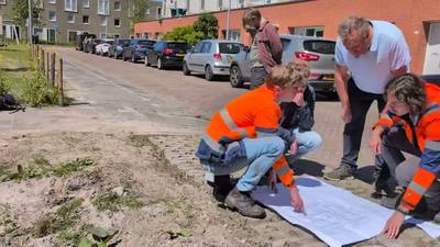
Videoverslag van de jaarlijkse ronde infiltratiesten die we als Hanze in samenwerking met de Gemeente Groningen in verschillende maatregelen doen. Dit keer de West-Indische buurt. De wadi's en doorlaatbare verhardingen zijn terug te vinden op Climatescan, waar we ook de data zullen publiceren.
YOUTUBE
Online knowledge-sharing platforms could potentially contribute to an accelerated climate adaptation by promoting more green and blue spaces in urban areas. The implementation of small-scale nature-based solutions (NBS) such as bio(swales), green roofs, and green walls requires the involvement and enthusiasm of multiple stakeholders. This paper discusses how online citizen science platforms can stimulate stakeholder engagement and promote NBS, which is illustrated with the case of ClimateScan. Three main concerns related to online platforms are addressed: the period of relevance of the platform, the lack of knowledge about the inclusiveness and characteristics of the contributors, and the ability of sustaining a well-functioning community with limited resources. ClimateScan has adopted a “bottom–up” approach in which users have much freedom to create and update content. Within six years, this has resulted in an illustrated map with over 5000 NBS projects around the globe and an average of more than 100 visitors a day. However, points of concern are identified regarding the data quality and the aspect of community-building. Although the numbers of users are rising, only a few users have remained involved. Learning from these remaining top users and their motivations, we draw general lessons and make suggestions for stimulating long-term engagement on online knowledge-sharing platforms
DOCUMENT

''There is a clear demand for a collaborative knowledge-sharing on climate adaptation and mitigation. As a consequence of urban expansion, green spaces are lost and the available areas for pervious green areas are decreasing. Many cities will experience greater impacts from flooding and heatstress due to climate change. Blue-green and small scale Nature-based solutions (NBS) such as bio swales, raingardens and wetlands offer opportunities to adapt urban areas to the impacts of climate change, but their multiple benefits are often unknown to the wider public. Research suggests that effective management of mitigate flood events and heat stress will be achieved by applying a range of NBS measures at different locations in cities [Majidi et al 2019]. Mapping of these (potential) locations for NBS will raise awareness and contribute to capacity building on climate adaptation. Some open source Climate Change Adaptation Platforms (CCAPs) allow mapping of NBS by citizen science and can help to inform and inspire different stakeholders on the topic of climate adaptation in respective region. The aim of most CCAPs is to facilitate an open and free exchange of knowledge on an international scale. Raising awareness about climate adaptation in urban areas and promoting NBS are also key aims.''
DOCUMENT
There is a wide diversity of projects undertaken to address urban resillience and climate proofing in the world. International knowledge exchange tools are evaluated with result: stakeholders demand tools that are interactive, open source and provide more detailed information (location, free photo and film material). This abstract details the outcomes of an interactive web-based map application for international knowledge exchange on 'blue-green' projects around the globe. Climatescan.nl has proven to be a successful tool with over 5000 users and more than 2000 international projects. The tool is used in several international workshops and serves the needs of different stakeholders.
DOCUMENT

Natuurvriendelijke wadi’s, regenwatertuinen en infiltrerende verhardingen zijn in trek bij gemeenten en waterschappen die zich bezighouden met klimaatbestendig maken van steden, wijken en dorpen. Dat blijkt uit de Top 21 die is samengesteld op basis van de clicks van bezoekers van de website Climatescan.nl. Verdwenen uit de top 10: waterpleinen en holle rotondes.
LINK
