The stability of upstream deposited tailings dams is dependent on maintaining a drawn down phreatic surface and unsaturated profile in its outer edge. However, it has been speculated that intense rainfall events could induce unexpected translation of pore air and water pressures into the tailings profile and thus compromise the effective stress in the unsaturated zone or result in a sudden rise in the phreatic surface. This phenomenon, known as the Lisse effect, has been observed and studied in hydrological sciences to explain the rapid delivery of antecedent hillslope groundwater during storm events. However, the phenomenon has not been comprehensively applied to evaluating tailings dam slope stability. In this paper, the outcomes of controlled observations of the phenomenon in column and analytical experiments, are assembled and evaluated in terms of the surface water application volumes and rate, the properties of the porous media and the resultant nature of pore pressure and phreatic surface responses. In addition, application of applied theories to evaluate the rapid transmission of pore pressures through a profile in response to an advancing wetting front, leads to the development of a methodology that could be applied to tailings materials of a range of hydraulic conductivities and water retention characteristics. The theory is applied to a series of profiles of different tailings porous media, using varied water application rates. Resultant perturbations in phreatic surface elevation and changes to pore pressures in the unsaturated zone are used to evaluate changes in effective stress distribution in the unsaturated outer wedge and subsequent stability criteria. A possible evaluation algorithm for assessing stability criteria is suggested.
MULTIFILE
Swales are widely used Sustainable Urban Drainage Systems (SuDS) that can reduce peak flow, collect and retain water and improve groundwater recharge. Most previous research has focused on the unsaturated infiltration rates of swales without considering the variation in infiltration rates under extreme climate events, such as multiple stormwater events after a long drought period. Therefore, fieldwork was carried out to collect hydraulic data of three swales under drought conditions followed by high precipitation. For this simulation, a new full-scale infiltration method was used to simulate five rainfall events filling up the total storage volume of the swales under drought conditions. The results were then compared to earlier research under regular circumstances. The results of this study show that three swales situated in the same street show a variation in initial infiltration capacity of 1.6 to 11.9 m/d and show higher infiltration rates under drought conditions. The saturated infiltration rate is up to a factor 4 lower than the initial unsaturated rate with a minimal rate of 0.5 m/d, close to the minimum required infiltration rate. Significant spatial and time variable infiltration rates are also found at similar research locations with multiple green infrastructures in close range. If the unsaturated infiltration capacity is used as the design input for computer models, the infiltration capacity may be significantly overestimated. The innovative method and the results of this study should help stormwater managers to test, model, plan and schedule maintenance requirements with more confidence, so that they will continue to perform satisfactorily over their intended design lifespan.
DOCUMENT
Due to climate change the frequency of extreme precipitation increases. To reduce the risk of damage by flooding, municipalities will need to retrofit urban areas in a climate-resilient way. To justify this investment, they need insight in possibilities and costs of climate-resilient urban street designs. This chapter focused on how to retrofit characteristic (Dutch) typologies of urban residential areas. For ten cases alternative street layouts were designed with a determination of the life cycle costs and benefits. All designs are resilient to extreme rain events. The results show that most flat urban typologies can easily be retrofitted in a climate-resilient way without additional costs compared to the standard way of retrofitting. Climate proofing sloping areas are highly dependent on the situation downstream. When there is no space downstream to divert the water into waterways or parks, costs to provide storage easily rise above traditional levels for retrofitting. In addition to reducing flood risk, for each case one variant includes resilience to extreme heat events making use of green. The life cycle costs and benefits of the green variants showed that especially green designs in high-density urban areas result in a better value for money.
MULTIFILE

Abstract: Climate change is related with weather extremes, which may cause damages to infrastructure used by freight transport services. Heavy rainfall may lead to flooding and damage to railway lines, roads and inland waterways. Extreme drought may lead to extremely low water levels, which prevent safe navigation by inland barges. Wet and dry periods may alternate, leaving little time to repair damages. In some Western and Middle-European countries, barges have a large share in freight transport. If a main waterway is out of service, then alternatives are called for. Volume- and price-wise, trucking is not a viable alternative. Could railways be that alternative? The paper was written after the unusually long dry summer period in Europe in 2022. It deals with the question: If the Rhine, a major European waterway becomes locally inaccessible, could railways (temporarily) play a larger role in freight transport? It is a continuation of our earlier research. It contains a case study, the data of which was fed into a simulation model. The model deals with technical details like service specification route length, energy consumption and emissions. The study points to interesting rail services to keep Europe’s freight on the move. Their realization may be complex especially in terms of logistics and infrastructure, but is there an alternative?
MULTIFILE

Natural disasters are a growing concern around the globe. In the Netherlands, water has always played an important role as both friend and enemy. To quickly analyze and visualise possible disaster outcomes has been really difficult. In collaboration with engineering company Tauw we improved this modellingwith an interdisciplinary team of GIS experts, High performance computing and real time visualisation. In a pilot for the city center of Groningen we developed a 3D version of flooding landscape maps (RUG, 2014) after modelling extreme rainfall. With a flooding landscape map you can see at a glance where water isgoing and where problem areas arise in case of extreme rainfall. Any municipality or county can thus quickly determine which measures are to be taken to prevent for example disruption to traffic or flooding damage tobuildings.
DOCUMENT

Permanent grassland soils can act as a sink for carbon and may therefore positively contribute to climate change mitigation and adaptation. We compared young (5–15 years since latest grassland renewal) with old (>20 years since latest grassland renewal) permanent grassland soils in terms of carbon stock, carbon sequestration, drought tolerance and flood resistance. The research was carried out on marine clay soil at 10 dairy farms with young and old permanent grassland. As hypothesized, the carbon stock was larger in old grassland (62 Mg C ha−1) topsoil (0–10 cm) than in young grassland topsoil (51 Mg C ha−1). The carbon sequestration rate was greater in young (on average 3.0 Mg C ha−1 year−1) compared with old grassland (1.6 Mg C ha−1 year−1) and determined by initial carbon stock. Regarding potential drought tolerance, we found larger soil moisture and soil organic matter (SOM) contents in old compared with young grassland topsoils. As hypothesized, the old grassland soils were more resistant to heavy rainfall as measured by water infiltration rate and macroporosity (at 20 cm depth) in comparison with the young grassland soils. In contrast to our hypothesis we did not find a difference in rooting between young and old permanent grassland, probably due to large variability in root biomass and root tip density. We conclude that old grasslands at dairy farms on clay soil can contribute more to the ecosystem services climate change mitigation and climate change adaptation than young grasslands. This study shows that under real farm conditions on a clay topsoil, carbon stock increases with grassland age and even after 30 years carbon saturation has not been reached. Further study is warranted to determine by how much extending grassland age can contribute to climate change mitigation and adaptation.
DOCUMENT

Global climate change will result in more extreme heat, drought, and rainfall. The urban environment is particularly vulnerable to these effects. Adaptation to these extreme weather conditions is difficult due to the high complexity of urban land-use patterns and stakeholder configurations. The current practice in the field of urban climate adaptation mainly revolves around the assessment of climatological risks, leaving the question where measures can be implemented under-researched. This study proposes and tests a four-step GIS-based Decision Support Model (DSM) to map the spatial opportunities for adaptation measures in public and private spaces. The DSM was applied to the city of Groningen. The findings revealed that there is a relationship between urban design, climatological risks, and opportunities for adaptation measures, with higher density neighbourhoods showing more opportunities for greening private properties and permeable pavements and lower density neighbourhoods showing opportunities for the implementation of green-blue measures in public space. The application of this DSM can aid urban planners and other stakeholders in mapping spatial opportunities for climate adaptation, that is, allow for more precise site selection for adaptation efforts and for an evaluation of adaptation efforts in different neighbourhood typologies within the urban environment.
DOCUMENT
In today’s city environments, extreme weather conditions are a fact oflife. Amsterdam, Mumbai, Nairobi or Sydney… climate change issuesneed to be tackled all around the world.In the last couple of decades, Amsterdam has dealt with largeramounts of rainwater, severe heat stress and a decreased biodiversity.In order to strengthen urban resilience to climate change, blue-green(BG) roofs are increasingly being introduced. BG roofs placean additional water layer underneath the green layer. The idea is thatthese roofs reduce runoff after rainfall by retaining precipitation andmitigate heat stress, caused by increased evapotranspiration (the sumof evaporation from the land surface and transpiration from plants)and a higher albedo effect (the ability of surfaces to reflect sunlight).
MULTIFILE
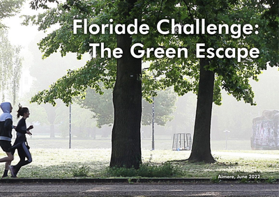
Almere is a green city where the greenery extends into the centre through a framework of nature, forests, parks and canals. With this green environment, Almere fulfils an important condition for a liveable city, where it is pleasant to live and work. An important goal for the municipality is to challenge its residents to develop a healthy lifestyle by using that green framework.But what really motivates Almeerders to go outside to exercise, enjoy the surroundings and meet each other? Are there sufficient green meeting or sports facilities nearby? Could the routes that connect the living and working environment with the larger parks or forests be better designed? And can those routes simultaneously contribute to climate adaptation?With the Green Escape Challenge, we invited students and young professionals to work on these assignments together.
DOCUMENT
Global society is confronted with various challenges: climate change should be mitigated, and society should adapt to the impacts of climate change, resources will become scarcer and hence resources should be used more efficiently and recovered after use, the growing world population and its growing wealth create unprecedented emissions of pollutants, threatening public health, wildlife and biodiversity. This paper provides an overview of the challenges and risks for sewage systems, next to some opportunities and chances that these developments pose. Some of the challenges are emerging from climate change and resource scarcity, others come from the challenges emerging from stricter regulation of emissions. It also presents risks and threats from within the system, next to external influences which may affect the surroundings of the sewage systems. It finally reflects on barriers to respond to these challenges. http://dx.doi.org/10.13044/j.sdewes.d6.0231 LinkedIn: https://www.linkedin.com/in/sabineeijlander/ https://www.linkedin.com/in/karel-mulder-163aa96/
MULTIFILE

