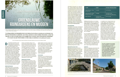
Kunnen wadi’s en raingardens overal? Hoe regel je het beheer? Wat is de ecologische waarde van een wadi of raingarden? Hoe overtuig ik de gemeente? In sneltreinvaart toont Floris Boogaard (Hanzehogeschool Groningen en Deltares) honderden inspirerende voorbeelden. Hij geeft daarmee antwoord op de meest gestelde vragen over wadi’s en raingardens: het kan (bijna) overal en de woonomgeving wordt er leefbaarder van.
LINK
MULTIFILE

De volksgezondheid is het belangrijkste doel van de riolering. Door de afvoer en zuivering van ons afvalwater is de sterfte aan infectieziektes en epidemieën, zoals cholera, dysenterie en andere dodelijke infectieziekten, verleden tijd geworden. Om dat zo te houden dienen we de mogelijke risico's te kennen, nieuwe (inter)nationale ontwikkelingen als 'van groen naar grijs' kritisch te bekijken en indien nodig ons waterbeheer en ons gedrag aan te passen.
IMAGE
Greater New Orleans is surrounded by wetlands, the Mississippi River and two lakes. Excess rain can only be drained off with pumping systems or by evaporation due to the bowl-like shape of a large part of the city. As part of the solution to make New Orleans climate adaptive, green infrastructure has been implemented that enable rainfall infiltration and evapotranspiration of stored water after Hurricane Katrina in 2005. The long-term efficiency of infiltrating water under sea level with low permeable soils and high groundwater tables is often questioned. Therefore, research was conducted with the full-scale testing method measuring the infiltration capacity of 15 raingardens and 6 permeable pavements installed in the period 2011–2022. The results show a high variation of empty times for raingardens and swales: 0.7 to 54 m/d. The infiltration capacity decreased after saturation (ca 30% decrease in empty time after refilling storage volume) but all the tested green infrastructure met the guideline to be drained within 48 h. This is in contrast with the permeable pavement: only two of the six tested locations had an infiltration capacity higher than the guideline 10 inch/h (254 mm/h). The results are discussed with multiple stakeholders that participated in ClimateCafe New Orleans. Whether the results are considered unacceptable depends on a number of factors, including its intended purpose, site specific characteristics and most of all stakeholder expectations and perceptions. The designing, planning and scheduling of maintenance requirements for green infrastructure by stormwater managers can be carried out with more confidence so that green infrastructure will continue to perform satisfactorily over the intended design life and can mitigate the effects of heavy rainfall and droughts in the future.
DOCUMENT
Cities are becoming increasingly vulnerable to climate change, and there is an urgent need to make them more resilient. The Climatescan adaptation tool www.climatescan.nl is applied as an interactive tool for knowledge exchange and raising awareness on Nature-Bases Solutions (NBS) targeting young professionals in ClimateCafes. Climatescan is a citizen science tool created through ‘learning by doing’, which is interactive, open source, and provide more detailed information on Best Management Practices (BMPs) as: exact location, website links, free photo and film material. BMPs related to Innovations for Climatic Events (INXCES) as stormwater infiltration by swales, raingardens, water squares, green roofs subsurface infiltration are mapped and published on social media. Climatescan is in continuous development as more data is uploaded by over 250 people around the world, and improvements are made to respond to feedback from users. In an early stage of the international knowledge exchange tool Climatescan, the tool was evaluated by semi-structured interviews in theClimatescan community with the following result: stakeholders demand tools that are interactive, open source, and provide more detailed information (location, free photo and film material). In 2016 Climatescan (first stage of INXCES) was turned into an APP and within two years the tool had over10,000 users and more than 3,000 international projects. More than 60% of the users are younger than 34 and 51% of users are female, resulting in engagement with an important target group: young professionals. The tool is applied in Climatecafe.nl around the world (The Netherlands, Sweden, Philippines, Indonesia, South Africa) where in a short period of time stakeholders in triple helix context (academia, public and private sector) work on climate related challenges and exchange their knowledge in a café setting. Climatescan has also been used in other water challenges with young professionals such as the Hanseatic Water City Challenge and Wetskills. During the INXCES project over 1000 BMPs related to Innovations for Climatic Events (INXCES) are mapped inall partner countries (figure 1). The points of interest vary from just a location with a short description to a full uploaded project with location, description and summary, photos and videos, presentations, links to websites with more information and scientific papers and books (as Bryggen in Norway: https://www.climatescan.nl/projects/16/detail ).
DOCUMENT

Onderzoek in Arnhem leert dat de infiltratiecapaciteiten van doorlatende verharding en regenwatertuinen voldoende is om forse buien te verwerken maar verschillen in tijd en ruimte. Bij goed ontwerp, aanleg en beheer kunnen deze regenwatervoorzieningen een goede bijdrage leveren aan het vasthouden, bergen en afvoeren van regenwater in het stedelijk gebied.
LINK
Online knowledge-sharing platforms could potentially contribute to an accelerated climate adaptation by promoting more green and blue spaces in urban areas. The implementation of small-scale nature-based solutions (NBS) such as bio(swales), green roofs, and green walls requires the involvement and enthusiasm of multiple stakeholders. This paper discusses how online citizen science platforms can stimulate stakeholder engagement and promote NBS, which is illustrated with the case of ClimateScan. Three main concerns related to online platforms are addressed: the period of relevance of the platform, the lack of knowledge about the inclusiveness and characteristics of the contributors, and the ability of sustaining a well-functioning community with limited resources. ClimateScan has adopted a “bottom–up” approach in which users have much freedom to create and update content. Within six years, this has resulted in an illustrated map with over 5000 NBS projects around the globe and an average of more than 100 visitors a day. However, points of concern are identified regarding the data quality and the aspect of community-building. Although the numbers of users are rising, only a few users have remained involved. Learning from these remaining top users and their motivations, we draw general lessons and make suggestions for stimulating long-term engagement on online knowledge-sharing platforms
DOCUMENT

DOCUMENT
DOCUMENT

