This booklet reports on experiments carried out by Van Hall Larenstein University of Applied Sciences in the context of the VALUE project. It consists of three parts. The first two chapters describe some experiments carried out in the Dutch town of Amersfoort and the students’ input and approach. This is followed by an intermezzo on sources of inspiration outside the Netherlands and examples of the way urban green spaces and elements can provide an impulse for towns and cities. The final two chapters concern the way such a green strategy can be designed in Dutch urban settings. Chapter 5 discusses how local governments can use the added value provided by urban green spaces for new investments:value capturing. Chapter 6 focuses on a new type of planning: Planning by Surprise, which combines dreams and pragmatism. The photo essay at the centre of the book tells the story of the many sides of green spaces in towns and cities. Unintentional, intentional, planned, dreamed of, drawn,remembered, pictured, developed: Planning by Surprise.
DOCUMENT

This article will explore the Cradle to Cradle (C2C) framework for urban environments, focusing on the perception, utilization and maintenance of parks. The case study explores the perception of urban flora and the value of greenery in everyday life in The Netherlands. The reflection section addresses the difference between conventional and C2C approaches to greenery on the one hand and current green management policies and public opinion on the other hand. The author reflects on how urban planning policies can be better geared towards public awareness of C2C, and towards the implementation of ecologically benign management of urban flora. It is proposed that an implementation of urban green management consistent with C2C is feasible and desirable. It is feasible given the favorable shifts in public opinion in relation to urban sustainability, and it is desirable due to the basic cost-benefit analysis and increased need for urban sustainability. This is a post-peer-review, pre-copyedit version of an article published in Urban Ecosystems. The final authenticated version is available online at: https://doi.org/10.1007/s11252-015-0468-2 https://www.linkedin.com/in/helenkopnina/
MULTIFILE

Green spaces play an important role in urban areas. We study the accessibility of green urban areas by combining open data sets about green with population size data. We develop a mathematical model to define the population density of a green area and calculate the available green space depending on the location. To this end, we do not only consider walking distance to and size of the green area, but also take into account the local population size. Our model quantifies how the available green space depends on the location in the city, such that heavily populated areas have a small amount of green available, even when closely located to a green area.
DOCUMENT

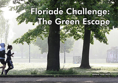
Almere is a green city where the greenery extends into the centre through a framework of nature, forests, parks and canals. With this green environment, Almere fulfils an important condition for a liveable city, where it is pleasant to live and work. An important goal for the municipality is to challenge its residents to develop a healthy lifestyle by using that green framework.But what really motivates Almeerders to go outside to exercise, enjoy the surroundings and meet each other? Are there sufficient green meeting or sports facilities nearby? Could the routes that connect the living and working environment with the larger parks or forests be better designed? And can those routes simultaneously contribute to climate adaptation?With the Green Escape Challenge, we invited students and young professionals to work on these assignments together.
DOCUMENT
Since it is insufficiently clear to urban planners in the Netherlands to what extent design measures can reduce heat stress and which urban spaces are most comfortable, this study evaluates the impact of shading, urban water, and urban green on the thermal comfort of urban spaces during hot summer afternoons. The methods used include field surveys, meteorological measurements, and assessment of the PET (physiological equivalent temperature). In total, 21 locations in Amsterdam (shaded and sunny locations in parks, streets, squares, and near water bodies) were investigated. Measurements show a reduction in PET of 12 to 22 °C in spaces shaded by trees and buildings compared to sunlit areas, while water bodies and grass reduce the PET up to 4 °C maximum compared to impervious areas. Differences in air temperature between the locations are generally small and it is concluded that shading, water and grass reduce the air temperature by roughly 1 °C. The surveys (n = 1928) indicate that especially shaded areas are perceived cooler and more comfortable than sunlit locations, whereas urban spaces near water or green spaces (grass) were not perceived as cooler or thermally more comfortable. The results of this study highlight the importance of shading in urban design to reduce heat stress. The paper also discusses the differences between meteorological observations and field surveys for planning and designing cool and comfortable urban spaces. Meteorological measurements provide measurable quantities which are especially useful for setting or meeting target values or guidelines in reducing urban heat in practice.
DOCUMENT

Nature in cities serves a multitude of purposes, one of which is that it provides citizens opportunities to recover from stressful daily urban life. Such stress recovering effects of nature can be experienced through urban green, which in urban planning and design contexts can be divided into large natural areas - urban green space - and small scale elements in urban streets: the urban greenscape. The current study aims at finding the extent to which various small scale natural elements in residential streets and their possible configurations influence citizens' preferences for those streets. The research was conducted through an online survey in four cities in the Netherlands (n = 4,956). It used stated choice methods in a virtual environment street design. The method yielded high quality data, indicating that the use of virtual environments and imagery is suitable for stated choice research in the built environment. The results show that especially trees very strongly influence preference, indicating they deserve more attention and space in cities. Grass, which is typically favored by local governments, and vertical green have the smallest effects in residential streets. Furthermore, the concept of greenscape intensity is introduced as the intensities of both the element and the configuration were found to be highly relevant. The results clearly show that the higher either of these intensities, the more likely a respondent will prefer the greenscape design. Furthermore, low intensity on the one can be compensated by high intensity on the other. With these results, urban design professionals and local governments can better trade-off the different aspects of costs versus positive effects of urban greenscape designs.
MULTIFILE
Post-war urban neighbourhoods in industrialised countries have been shown to negatively affect the lifestyles of their residents due to their design. This study aims at developing an empirical procedure to select locations to be redesigned and the determinants of health at stake in these locations, with involvement of residents’ perspectives as core issue. We addressed a post-war neighbourhood in the city of Groningen, the Netherlands. We collected data from three perspectives: spatial analyses by urban designers, interviews with experts in local health and social care (n = 11) and online questionnaires filled in by residents (n = 99). These data provided input for the selection of locations to be redesigned by a multidisciplinary team (n = 16). The procedure yielded the following types of locations (and determinants): An area adjacent to a central shopping mall (social interaction, traffic safety, physical activity), a park (experiencing green, physical activity, social safety, social interaction) and a block of low-rise row houses around a public square (social safety, social interaction, traffic safety). We developed an empirical procedure for the selection of locations and determinants to be addressed, with addressing residents’ perspectives. This procedure is potentially applicable to similar neighbourhoods internationally.
DOCUMENT

Cities worldwide are growing at unprecedented rates, compromising their surrounding landscapes, and consuming many scarce resources. As a consequence, this will increase the compactness of cities and will also decrease the availability of urban green space. In recent years, many Dutch municipalities have cut back on municipal green space and itsmaintenance. To offer a liveable environment in 30 to 50 years, cities must face challenges head-on and strive to create green urban areas that build on liveable and coherent sustainable circular subsystems.
DOCUMENT

