As it becomes clear that climate change is not easily within the boundaries of the 1990's, society needs to be prepared and needs to anticipate future changes due to the uncertain changes in climate. So far, extensive research has been carried out on several issues including the coastal defence or shifting ecozones. However, the role spatial design and planning can play in adapting to climate change has not yet been focussed on.This book illuminates the way adaptation to climate change is tackled in water management, ecology, coastal defence, the urban environment and energy. The question posed is how each sector can anticipate climate change by creating spatial designs and plans. The main message of this book is that spatial design and planning are a very useful tool in adapting to climate change. It offers an integral view on the issue, it is capable in dealing with uncertainties and it opens the way to creative and anticipative solutions. Dealing with adaptation to climate change requires a shift in mindset; from a technical rational way of thinking towards an integral proactive one. A new era in spatial design and planning looms on the horizon. © Springer Science+Business Media B.V. 2009.
DOCUMENT
The adaptation of urbanised areas to climate change is currently one of the key challenges in the domain of urban policy. The diversity of environmental determinants requires the formulation of individual plans dedicated to the most significant local issues. This article serves as a methodic proposition for the stage of retrieving data (with the PESTEL and the Delphi method), systemic diagnosis (evaluation of risk and susceptibility), prognosis (goal trees, goal intensity map) and the formulation of urban adaptation plans. The suggested solution complies with the Polish guidelines for establishing adaptation plans. The proposed methodological approach guarantees the participation of various groups of stakeholders in the process of working on urban adaptation plans, which is in accordance with the current tendencies to strengthen the role of public participation in spatial management. https://doi.org/10.12911/22998993/81658
MULTIFILE

The Northern Netherlands is like many delta’s prone to a wide range of climate change effects. Given the region its long history with floods and adaptation, there are numerous initiatives to be found that tried to battle these effects. As part of the Climate Adaptation Week Groningen, an inventory was made of these initiatives. The most inspiring ones were coined ‘best practices’, and analysed in order to learn lessons. A distinction was made between 4 regional landscape types. The first consists of the coastline itself, where the effects of the rising sea level begin to show. The second covers the farmlands near the coastlines, where challenges such as salinisation and the loss of biodiversity prevail. A third landscape covers the historically compact cities, which have to deal with rising temperatures and heavy rainfall in increasingly limited spaces. The fourth and final landscape comprises the wetlands surrounding the cities, where the natural capacity to retain and store rainwater is undermined by its agriculture usage. Most of these challenges form a risk for maintaining a liveable region. The best practices that were collected show a diverse set of innovations and experiments, both on small and large scales. Three main characteristics could be distinguished that illustrate trends in climate adaptation practices. First, many best practices were aimed at restoring and embracing the natural capacity of the different landscapes, giving more and more room for the building with nature concept as part of building resilience. Second, climate adaptation is seldomly focussed on as the sole function of a spatial intervention, and is almost always part of integrated plans in which biodiversity, agriculture, recreation or other themes are prolonged with it. A third and last characteristic shows that many projects embed a strong focus on the historical context of places as a source of inspiration and cultural identity. The best practices show how different ways of adapting are emerging and can inspire planners across the world.
DOCUMENT
Global climate change will result in more extreme heat, drought, and rainfall. The urban environment is particularly vulnerable to these effects. Adaptation to these extreme weather conditions is difficult due to the high complexity of urban land-use patterns and stakeholder configurations. The current practice in the field of urban climate adaptation mainly revolves around the assessment of climatological risks, leaving the question where measures can be implemented under-researched. This study proposes and tests a four-step GIS-based Decision Support Model (DSM) to map the spatial opportunities for adaptation measures in public and private spaces. The DSM was applied to the city of Groningen. The findings revealed that there is a relationship between urban design, climatological risks, and opportunities for adaptation measures, with higher density neighbourhoods showing more opportunities for greening private properties and permeable pavements and lower density neighbourhoods showing opportunities for the implementation of green-blue measures in public space. The application of this DSM can aid urban planners and other stakeholders in mapping spatial opportunities for climate adaptation, that is, allow for more precise site selection for adaptation efforts and for an evaluation of adaptation efforts in different neighbourhood typologies within the urban environment.
DOCUMENT
This report is the second in a series of three reports named Value Added Planning, consisting of three unique, but interconnected tools, namely the Green Credit Tool, the Workbench Method and Value Added Planning, These tools have been developed and/or tested in the context of the European INTERREG programme: VALUE (INTERREG IVB North West Europe - Valuing Attractive Landscapes in the Urban Economy), in which the municipality of Amersfoort is involved. Aim of this programme is to understand how green space in urban centres can become more competitive with other urban functions. In this context, the municipality of Amersfoort has introduced the interactive method named Workbench Spatial Quality (Werkbank Ruimtelijke Kwaliteit in Dutch) in their spatial design in several areas in their municipality. The Workbench Spatial Quality (to be referred to as Workbench) has been applied on two cases in Amersfoort: Park Randenbroek and Vathorst NW. In this report the Workbench as applied in Amersfoort is evaluated. Research was done on the basis of literature research, case-material and interviews performed with several experts. Furthermore, research was done by students at the Wageningen University and Research Centre (WUR). Part of the evaluation in this report makes use of a quick scan of 19 Dutch cases. The question addressed in this report is: 1.How was the Workbench Spatial Quality applied in Amersfoort? 2.Can the Workbench contribute to sustainable spatial planning?
DOCUMENT

Worldwide, rivers face challenges due to human and climatic pressures. Floods, droughts, pollution, damming and hydropeaking are only a few examples of these pressures, and influence the way rivers flow. Climate change adaptation projects increase the incentive to domesticate rivers, often legitimised through expert views on (future) vulnerability and risk. This emerging river imaginary dominates current debates in many rivers in our world. River imaginaries reflect spatially bound hydrosocial territories in which multiple actors on multiple scales from multiples sectors operate to reach varying objectives. They include water flows, ecological systems, climate conditions, hydraulic infrastructure, financial means, institutional arrangements, legal frameworks and information/knowledge hubs. In the context of climate change adaptation, river imaginaries are strongly dependent on the extent to which climate change is expected to influence rivers through a mixture of probable, possible, desirable or preferable versions of a (future) river. As such, knowledge-structures of future making are scrutinised in this research by emphasising on the role of change, the role of futures and the role of experts. This presentation aims to elucidate how river imaginaries have influenced river management under climate change adaptation that resulted in large infrastructural projects. Through a study of the Meuse river, a concrete case of a imaginary came into being in the Dutch-Belgian Border-Meuse trajectory. Moreover, preliminary result from adaptation projects in the marshlands of the lower Magdalena in Colombia strengthen the dominate imaginary of technocratic and ecocentric approaches to climate change adaptation where an expert view on local knowledge dominates.
DOCUMENT
Purpose: To establish age-related, normal limits of monocular and binocular spatial vision under photopic and mesopic conditions. Methods: Photopic and mesopic visual acuity (VA) and contrast thresholds (CTs) were measured with both positive and negative contrast optotypes under binocular and monocular viewing conditions using the Acuity-Plus (AP) test. The experiments were carried out on participants (age range from 10 to 86 years), who met pre-established, normal sight criteria. Mean and ± 2.5σ limits were calculated within each 5-year subgroup. A biologically meaningful model was then fitted to predict mean values and upper and lower threshold limits for VA and CT as a function of age. The best-fit model parameters describe normal aging of spatial vision for each of the 16 experimental conditions investigated. Results: Out of the 382 participants recruited for this study, 285 participants passed the selection criteria for normal aging. Log transforms were applied to ensure approximate normal distributions. Outliers were also removed for each of the 16 stimulus conditions investigated based on the ±2.5σ limit criterion. VA, CTs and the overall variability were found to be age-invariant up to ~50 years in the photopic condition. A lower, age-invariant limit of ~30 years was more appropriate for the mesopic range with a gradual, but accelerating increase in both mean thresholds and intersubject variability above this age. Binocular thresholds were smaller and much less variable when compared to the thresholds measured in either eye. Results with negative contrast optotypes were significantly better than the corresponding results measured with positive contrast (p < 0.004). Conclusions: This project has established the expected age limits of spatial vision for monocular and binocular viewing under photopic and high mesopic lighting with both positive and negative contrast optotypes using a single test, which can be implemented either in the clinic or in an occupational setting.
DOCUMENT

Recent advancements in mobile sensing and wearable technologies create new opportunities to improve our understanding of how people experience their environment. This understanding can inform urban design decisions. Currently, an important urban design issue is the adaptation of infrastructure to increasing cycle and e-bike use. Using data collected from 12 cyclists on a cycle highway between two municipalities in The Netherlands, we coupled location and wearable emotion data at a high spatiotemporal resolution to model and examine relationships between cyclists' emotional arousal (operationalized as skin conductance responses) and visual stimuli from the environment (operationalized as extent of visible land cover type). We specifically took a within-participants multilevel modeling approach to determine relationships between different types of viewable land cover area and emotional arousal, while controlling for speed, direction, distance to roads, and directional change. Surprisingly, our model suggests ride segments with views of larger natural, recreational, agricultural, and forested areas were more emotionally arousing for participants. Conversely, segments with views of larger developed areas were less arousing. The presented methodological framework, spatial-emotional analyses, and findings from multilevel modeling provide new opportunities for spatial, data-driven approaches to portable sensing and urban planning research. Furthermore, our findings have implications for design of infrastructure to optimize cycling experiences.
MULTIFILE
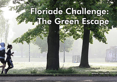
Almere is a green city where the greenery extends into the centre through a framework of nature, forests, parks and canals. With this green environment, Almere fulfils an important condition for a liveable city, where it is pleasant to live and work. An important goal for the municipality is to challenge its residents to develop a healthy lifestyle by using that green framework.But what really motivates Almeerders to go outside to exercise, enjoy the surroundings and meet each other? Are there sufficient green meeting or sports facilities nearby? Could the routes that connect the living and working environment with the larger parks or forests be better designed? And can those routes simultaneously contribute to climate adaptation?With the Green Escape Challenge, we invited students and young professionals to work on these assignments together.
DOCUMENT