Purpose Social media have become a key part of placemaking. Placemaking revolves around collaboration between multiple stakeholders, which requires ongoing two-way communication between local government and citizens. Although social media offer promising tools for local governments and public professionals in placemaking, they have not lived up to their potential. This paper aims to uncover the tensions and challenges that social media bring for public professionals at the street level in placemaking processes. Design/methodology/approach This study aims to fill this gap with a case study of area brokers engaged in online placemaking in Amsterdam. In total, 14 in-depth semi-structured interviews were conducted, focusing on area brokers’ social media practices, perceptions and challenges. The authors used an open coding strategy in the first phase of coding. In the second phase, the authors regrouped codes in thematic categories with the use of sensitizing concepts derived from the theoretical review. Findings The use of social media for placemaking imposes demands on area brokers from three sides: the bureaucracy, the affordances of social media and affective publics. The paper unpacks pressures area brokers are under and the (emotional) labour they carry out to align policy and bureaucratic requirements with adequate communication needed in neighbourhood affairs on social media. The tensions and the multidimensionality of what is required explain the reluctance of area brokers to exploit the potential of social media in their work. Originality/value Several studies have addressed the use of social media in placemaking, but all neglected the perspective of street-level bureaucrats who shape the placemaking process in direct contact with citizens.
MULTIFILE
In 2017 the municipality of Amsterdam launched a programme to combat a housingshortage and realise ambitious societal goals for 32 of its most deprived neighbourhoods. After decades of urban renewal projects, these areas still scored poorly on most socio-economic indicators. The programme aims to develop more affordable housing for low- and middleincome households, to revitalise the existing public spaces of these neighbourhoods and to improve the residents’ socio-economic position. In addition, the progressive municipal council installed in 2018 intends to democratise urban renewal processes with the aim of increasing community involvement.
DOCUMENT

Cities are confronted with more frequent heatwaves of increasing intensity discouraging people from using urban open spaces that are part of their daily lives. Climate proofing cities is an incremental process that should begin where it is needed using the most cost-efficient solutions to mitigate heat stress. However, for this to be achieved the factors that influence the thermal comfort of users, such as the layout of local spaces, their function and the way people use them needs to be identified first. There is currently little evidence available on the effectiveness of heat stress interventions in different types of urban space.The Cool Towns Heat Stress Measurement Protocol provides basic guidance to enable a full Thermal Comfort Assessment (TCA) to be conducted at street-level. Those involved in implementing climate adaptation strategies in urban areas, such as in redevelopments will find practical support to identify places where heat stress may be an issue and suggestions for effective mitigation measures. For others, such as project developers, and spatial designers such as landscape architects and urban planners it provides practical instructions on how to evaluate and provide evidence-based justification for the selection of different cooling interventions for example trees, water features, and shade sails, for climate proofing urban areas.
MULTIFILE

People during this Covid-19 year were forced to spend more time at home due to the lockdown and extreme weather conditions. Before the crisis, people already spent approximately 90 percent of their time indoors and relied on nearby public outdoor spaces for social and physical activities to maintain their health and well-being. During the pandemic, unhealthy, overcrowded, uncomfortable outdoor public spaces and a lack of greenery likely encouraged people to stay indoors even more. In city centres, greenery is often scarce: municipalities struggle to find nature-based solutions that meet the multiple functions of these areas.Fortunately, pandemics appear to spur cities to create healthier, greener environments. The nineteenth-century cholera pandemics, for example, led many western cities to establish large public parks to act as green lungs. These include Central Park and Prospect Park in New York, designed by the influential landscape architect Frederick Law Olmsted. The Covid-19 crisis creates the momentum to bring nature back into our cities and to repair vital ecosystem functions and derived Urban Ecosystem Services (UESs).In this action-research study we adopted the Panarchy model and its principle that initiatives on a fine-grained scale can eventually have a positive impact on the entire ecosystem. Green interventions at street-level hold the promise that they may activate communities to initiate change for more social-ecological resilience. This paper describes two experimental projects: The Climate Cube, installed at a shopping centre in the Nieuw-West district in Amsterdam, and the Rewilding Stepping Stones in the centre of New Town Almere. The Climate Cube consists of a pergola, large, interconnected planter boxes, and benches on each side and acts as a cool social spot. The aim is to explore how it might improve visitors’ (thermal) comfort and to build community support before larger redevelopment projects are launched. The Rewilding Stepping Stones are made of biobased and recycled materials and planted with native species to encourage nature to return to the city centre.
DOCUMENT

Currently, there is no method available that can systematically score the available ecosystem services in streets or street segments in suburban districts. In this study, different climate adaptation measures and their ecosystem services were categorized into green, blue, and grey categories and weight was given to each category based on their impact on the microclimate. This study took place in the Hillesluis district in the city of Rotterdam and the Paddepoel district in the city of Groningen. In Rotterdam, 21 streets, composed of 42 street segments, were assessed. In Groningen, 17 streets, composed of 45 street segments, were assessed. The available ecosystem services of each street segment were scored from 0–100. The scorecard method that was developed and tested during this study provided insight in the variation of available ecosystem services of streets and street segments. Individual street scores were very low in the city of Rotterdam and ranged between 3 and 50, with the average score for the street segments of 29. In Groningen, the scores were considerably higher with a range between 23 and 70, with an average score of 47 per street segment. The presence of larger green trees, front yards, and façade gardens in the green category are the most distinctive variable, while adaptation measures in the blue category were absent in both cities. The scorecard proved to be very useful in the adaptation labeling of street segments and entire streets. After assessing a neighborhood, the least adaptive streets can be identified relatively easy. Based on the score a label can be given between A+++ and G. The scorecard informs residents and decision makers about which streets are most adaptive and which streets have an adaptation potential. The method can easily be duplicated and used by local governments and community groups to have better insight in the level of climate adaptation of their street. Labels for entire streets can be used to create awareness and encourage residents to take action and expand the number of climate adaptation measures in their street.
DOCUMENT
Built environments are increasingly vulnerable to the impacts of climate change. Most European towns and cities have developed horizontally over time but are currently in the process of further densification. High-rise developments are being built within city boundaries at an unprecedented rate to accommodate a growing urban population. This densification contributes to the Urban Heat Island phenomenon and can increase the frequency and duration of extreme heat events locally. These new build-up areas, in common with historic city centres, consist mainly of solid surfaces often lacking open green urban spaces.The Intervention Catalogue is the third publication in a series produced by the Cool Towns project and has been designed as a resource for decision makers, urban planners, landscape architects, environmental consultants, elected members and anyone else considering how to mitigate heat stress and increase thermal comfort in urban areas. Technical information on the effectiveness of the full array of intervention types from trees to water features, shading sails to green walls, has been assessed for their heat stress mitigation properties, expressed in Physiological Equivalent Temperature (PET). The results shown in factsheets will help the process of making an informed, evidence based, choice so that the most appropriate intervention for the specific spatial situation can be identified.
DOCUMENT

This study explores legal consciousness of social workers within the framework of the 2015 Social Support Act (SSA) in the Netherlands. The aim of this law is to provide social support and care to citizens with impairments or chronic psychological or psychosocial problems, with the goal of enabling people to live independently and actively participate in society. The SSA grants entitlement to a needs assessment to applicants, essential for accessing personalized provisions. This assessment is a pivotal legal evaluation for persons with disabilities to ultimately exercise their rights under the UN Convention on the Rights of Persons with Disabilities (CRPD), ratified by the Netherlands in 2016. With the use of the concept of legal consciousness, this study aims to contribute to understanding social workers’ experiences, understandings, and actions in relation to law in the context of legal decision-making on behalf of the council.
MULTIFILE

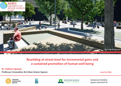
Presentation about the power of urban greening on street level
DOCUMENT